Win a Breathtaking Bryson City Giveaway

America's Favorite Drive
Threading through ancient peaks and emerald valleys, the Blue Ridge Parkway unfolds like a love letter to the Southern Appalachians. This iconic 469-mile mountain highway connects Virginia's Shenandoah to North Carolina's Great Smoky Mountains, weaving past cloud-kissed summits and mist-filled hollows. From Asheville, every curve northward or southward carries you higher into a realm of endless mountain horizons, hidden waterfalls, and hiking trails that beckon from nearly every overlook. The magic? It's all yours to discover without spending a dime – this national treasure welcomes all who seek mountain solitude and natural beauty. (Photo above: Linn Cove Viaduct)
The Blue Ridge Parkway is a gateway to incredible mountain adventures, secluded picnic havens, and those soul-stirring sunrise views. Smart travelers check DriveNC.gov before hitting the road to map out accessible routes. A bit of planning unlocks your perfect mountain escape in North Carolina. Note: Portions of the Parkway close in winter, and portions from Linville south toward Mount Mitchell will remain closed until Hurricane Helene repairs are complete. Visit the National Park Service website for up-to-date road and trail information.
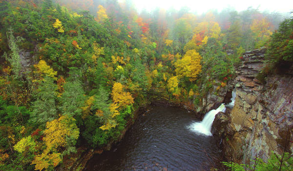
See our Top 12 Waterfalls to see along the Parkway. Above is Linville Falls.
See 15 Quick Hikes on the Blue Ridge Parkway.
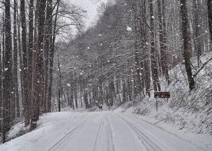
Winter 2025 Blue Ridge Parkway Road Status & Access Updates
The good news first: Several major sections of the Blue Ridge Parkway in North Carolina are now open and welcoming visitors back to experience the mountain magic.
Fall Blue Ridge Parkway Sections in Western NC
- Near Asheville: A spectacular 65-mile stretch between Mount Mitchell (MP 355.4) and NC Route 276 (MP 420) is open, providing access to beloved destinations like Mount Mitchell, Craggy Gardens, Craggy Pinnacle, Mount Pisgah hiking, Graveyard Fields waterfalls, and the Asheville area overlooks.
- Near Linville Falls/Grandfather Mountain: A beautiful 12-mile section between Bamboo Gap (MP 285.5) and Linville Falls (MP 317.5) is accessible, including the iconic Linn Cove Viaduct, Rough Ridge hiking trail, and Julian Price Park.
- Near the Great Smoky Mountains: The southern terminus sections from Waterrock Knob (MP 451) to Cherokee (MP 469) are open, including the scenic Heintooga Spur Road leading into Great Smoky Mountains National Park.
- Additional open sections include the area around Little Switzerland and Gillespie Gap (MP 324.7–333.9) and the highest elevations from Beech Gap through Richland Balsam (MP 423.2–451).
Temporarily Closed Blue Ridge Parkway Sections Include
- Milepost 316.5: Linville Falls Spur Road (Helene-related closure)
- Mileposts 317.5–324.7: South of Linville Falls area (Helene-related closure)
- Mileposts 324.7 - 330.9: Jacksontown Access Road to NC Highway 226 (Gillespie Gap) (Helene-related closure)
- Mileposts 342.1 - 344.2: Victor Crossing to NC Highway 80 (Helene-related closure)
- Mileposts 344.2 - 355.3: NC Highway 80 to Mount Mitchell State Park (Helene-related closure)
- Additional closures can occur: Check the NPS road closure map
Essential Planning Tip for Blue Ridge Parkway Travel: Road conditions change as repair work progresses. Always check the latest NPS road closure map before your trip, and heed all posted closures and detours. The National Park Service emphasizes that visitors must respect road-closed signs for safety reasons.
Despite ongoing repairs, the reopened sections offer incredible North Carolina mountain experiences. Spring brings wildflower displays along the roadsides – wild strawberries, dogwoods, flame azaleas, and blooming rhododendrons at higher elevations. Popular attractions, overlooks, and hiking trails in accessible areas are ready for exploration.
Below is our comprehensive mile-by-mile guide to key points of interest along a 175-mile stretch of the Blue Ridge Parkway in North Carolina (from Milepost 294 near Blowing Rock to Milepost 469 at Cherokee).
Asheville's Blue Ridge Parkway access points are around Mileposts 382–393. Use the mileposts (marked along the roadside) to navigate – cell service and GPS can be unreliable on the Parkway. Enjoy the journey, take it slow, and stop often for the best Blue Ridge Parkway photography!
Experience the Blue Ridge Parkway
 Vehicle Rentals
 Our Partner's on the Blue Ridge Parkway
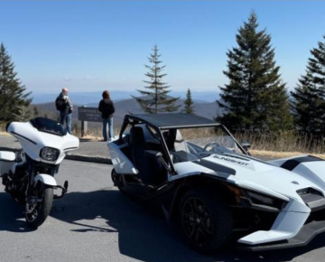
Engineered 4 Adventure: Motorcycle and Slingshot Rentals
Engineered 4 Adventure is a woman-owned motorcycle and Slingshot rental company near Asheville offering late-model bikes for exploring legendary routes like the Blue Ridge Parkway, The Dragon, and The Rattler, plus unique self-guided Long Way Ride Challenges. Transportation offered from the airport or lodging within 25 miles.
More InformationBlue Ridge Parkway Mile-By-Mile: Top 50 Things to Do
Here are our top picks for things to do along a 175-mile North Carolina section of the Parkway from north to south. Asheville exits are between Mileposts 382 and 393. Print this list or save it to your phone. Mobile phone service is spotty along the Parkway, and most of these places are not listed on GPS.
- Milepost 294, Moses H. Cone Memorial Park: Explore this historic estate on the Parkway near Blowing Rock. Tour the 1901 Flat Top Manor (Moses Cone's mansion), which houses a craft center, and wander carriage trails on 3,500 acres of forests and meadows. Moses Cone Park is a popular stop for horseback riding, hiking, and catching views of Bass Lake. See our Moses Cone Park Guide for details.
- Milepost 297, Julian Price Park: Adjacent to Moses Cone, Julian Price Park offers a beautiful mountain lake and lots of recreation. Price Lake has a 2.3-mile loop trail and canoe rentals in summer. Enjoy a picnic or camp at Price Park, or hike the Tanawha Trail that passes through. See our Julian Price Park Guide.
- Milepost 302.8, Rough Ridge: A short but steep 1/3-mile hike leads to a boardwalk with breathtaking views atop Rough Ridge. This overlook is part of the Tanawha Trail and offers one of the most photographed vistas of the Blue Ridge Mountains (especially striking in autumn). See more in our Rough Ridge Hiking Guide.
- Milepost 304.4, Linn Cove Viaduct: Drive across this engineering marvel – a curving concrete bridge clinging to the side of Grandfather Mountain. There's a visitor center (temporarily closed in 2025 for repairs) at the south end of the viaduct with exhibits about its construction. A short trail below the viaduct lets you walk under and see its design up close. See our Linn Cove Viaduct Guide. Note: The road here has reopened after storm repairs, restoring access to the viaduct.
- Milepost 305, Grandfather Mountain: Exit the Parkway here (US 221) to visit Grandfather Mountain State Park and the famous Mile-High Swinging Bridge (admission fee at the attraction gate). Grandfather's summit provides astonishing views and habitats (watch for soaring hawks). See our Grandfather Mountain Guide. The resort town of Banner Elk is 12 miles north via NC 184. See our Grandfather Mountain Guide. The great resort town of Banner Elk is 12-mile north via NC 184.
- Milepost 305.2, Beacon Heights: A short, moderate hike (0.7-mile round-trip) leads to a rock outcrop with panoramic views of Grandfather Mountain and the surrounding peaks. It's a great spot for a picnic on the rock slabs. See our Beacon Heights Hiking Guide.
- Milepost 308.3, Flat Rock Trail: A 0.6-mile loop hike through woods leads to a "flat" rocky summit with views of Grandfather Mountain. It's a lesser-known, peaceful spot for a picnic with ample scenery. See our Flat Rock Trail Guide.
- Milepost 312.2: Here NC 181 crosses the Parkway. If you turn south on NC 181 and drive ~4–6 miles, you can reach trailheads for spectacular hikes outside the Parkway: try the summits of Table Rock or Hawksbill Mountain in Linville Gorge, or cool off at Upper Creek Falls (5.5 miles south). Or go south 5.5 miles for Upper Creek Falls.
- Milepost 316.3, Linville Falls: Take an easy 1 or 1.5-mile hike to see the beautiful falls and gorge. Visitors Center and picnic area. See our Linville Falls Guide. Also see Duggers Creek Falls. Nearby is Linville Gorge.
- Milepost 317.4: A must-see waterfall and one of the Parkway's highlights. From the Linville Falls Visitor Center, choose an easy 1-mile trail or a slightly longer 1.5-mile trail to reach overlooks of the stunning multi-tiered falls roaring through Linville Gorge. There's a picnic area and restrooms here. See our Linville Falls Guide and check out nearby Duggers Creek Falls. (Linville Gorge Wilderness, just south, offers more adventures like Linville Caverns and backcountry hikes.) Note: The spur road to Linville Falls (MP 316.5) is currently closed. Linville Caverns is four miles south of the Parkway.
- Milepost 317.4 – US 221 Crossing (Linville): US 221 intersects here. Heading south on 221 provides a quicker route back toward Marion/Asheville via I-40 if needed. Just 4 miles south on 221 is Linville Caverns, an interesting limestone cave tour (open seasonally). Note: The Parkway is closed just south of this point (MP 317.5–324.7).
- Milepost 320.8, Chestoa View: Currently inaccessible due to road closure. A short walk from the parking area leads to one of the most sweeping views on this section of the Parkway. At 4,090 feet elevation, Chestoa View overlooks the Linville Gorge area. See our Chestoa View Guide.
- Milepost 328.3, The Orchard at Altapass: Currently inaccessible due to road closure. This historic apple orchard and cultural site is a fun stop in summer and early fall. Enjoy live mountain music, storytelling, hayrides through the orchards, and fresh apple goodies in season. See our Orchard at Altapass Guide. (Typically open May–October; check ahead if roads are open—this site is just south of the Little Switzerland area, near some road closures.) See our Orchard at Altapass Guide.
- Milepost 331, Museum of North Carolina Minerals (Highway 226): Currently accessible. Located at Gillespie Gap (where NC 226 crosses), this small free museum showcases the rich mineral and gem resources of the region. It's kid-friendly and has restrooms and a visitor info desk. See our Museum of NC Minerals Guide. (For a side trip, drive north on NC 226 about 6 miles to visit the town of Spruce Pine.) Free. See our Museum of NC Minerals Guide. Travel north on Highway 226 for six miles to Spruce Pine.
- Milepost 334, Little Switzerland: Currently accessible. A quaint alpine-style village just off the Parkway. At Switzerland Inn you'll find dining and gift shops, or pop into the general store and café. It's a refreshing stop for lunch or ice cream with a view. See our Little Switzerland Guide. (Only 3 miles from here is Emerald Village, a fascinating gem mining attraction and mining museum.) Note: The Parkway is closed just south of here (MP 333.9–342.1). See our Little Switzerland Guide. Just three miles away is Emerald Village and the NC Mining Museum.
- Milepost 339.5, Crabtree Falls & Meadows: Currently inaccessible due to road closure. A lovely area known for its campground and the Crabtree Falls Trail. The moderate 3-mile loop hike leads to a beautiful 70-foot waterfall in a lush cove. In late spring, wildflowers carpet the meadows (including the namesake crabapple trees). See our Guide to Crabtree Falls. Note: As of Fall 2025, the Crabtree Falls area is within a closure zone – the picnic area and campground here are currently closed.
- Milepost 344, NC 80 Junction (Buck Creek Gap): Currently inaccessible due to road closure. NC Highway 80 crosses here. In winter (or when the Parkway is closed in this area), NC 80 is the alternate route to reach Mount Mitchell from the south. Heading south on NC 80 takes you 18 miles down to Marion and I-40. Heading north on NC 80 leads toward the Burnsville area, with side trips to Roaring Fork Falls and Setrock Creek Falls near the community of Busick, plus scenic drives along the Mount Mitchell Scenic Byway. (This route is a favorite for motorcyclists.) Go south to Marion and I-40 (18 miles). Go north on NC 80 to Roaring Fork Falls, Setrock Creek Falls, Burnsville and Toe River Artist Studios. Part of the Mount Mitchell Scenic Byway.
- Milepost 350.4, Green Knob Overlook: Currently inaccessible due to road closure. Stop here for a distant view of the South Toe River valley and an access trail to Green Knob Tower, a historic fire lookout tower about 1.3 miles up the ridge. It's a lesser-used trail with rewarding views at the tower.
Hike to Green Knob Tower. - Milepost 355.4, Mt Mitchell: Currently accessible. Turn onto NC 128 and drive 4.6 miles to reach the summit of Mount Mitchell, the tallest peak east of the Mississippi (6,684 ft). On clear days, you'll have 85-mile panoramas from the observation deck. There are alpine spruce-fir forest trails at the top (like the short Balsam Nature Trail or the 2-mile round-trip to Mount Craig) and a seasonal restaurant for a mile-high lunch. No admission fee. See our guide to Mount Mitchell State Park.
- Milepost 358.9, Walker Knob Overlook: Currently accessible. Trailhead for the Big Butt Trail to Little Butt and Big Butt peaks – a strenuous backcountry hike along a ridgeline (notable for wildflowers and wild blueberries in summer). If you're not up for a long hike, the overlook itself offers a peaceful stop. See our Big Butt Trail Guide.
- Milepost 361.2, Glassmine Falls Overlook: Currently accessible. Across the valley, you'll glimpse Glassmine Falls, a slender 200-foot cascade spilling down the opposite mountainside. The waterfall is usually a trickle or even dry in summer, but after heavy rains it becomes much more visible. This overlook is at 5,200 ft elevation. See our Glassmine Falls Guide.
- Milepost 364.1, Craggy Dome & Pinnacle Trail: Currently accessible. This pull-off is the trailhead for the Craggy Pinnacle hike – a very popular 1.5-mile round-trip hike through rhododendron tunnels to a summit with 360° views. It's especially gorgeous in June, when Catawba rhododendrons bloom in a purple profusion. Arrive early; parking is limited. Parking Overlook and Craggy Pinnacle Hike.
- Milepost 364.4, Craggy Gardens: Currently accessible. A high-elevation visitor center and iconic viewpoint, about 24 miles north of downtown Asheville. Craggy Gardens offers sweeping vistas east and west, often above the clouds. Enjoy the cool, crisp air (elevation 5,640 ft) and maybe spot blueberries or blackberries along the short trail to Craggy Flats. In summer, the slopes around here are filled with pink-purple rhododendron blossoms. Read more: Craggy Gardens Guide and Craggy Gardens Trail.
- Milepost 367.6, Craggy Gardens Picnic Area: Currently accessible. A mile past the visitor center is a large picnic area among northern hardwoods. It has dozens of picnic tables and access to trails like the Craggy Gardens Trail. This spot is also known for stargazing due to the dark skies at high elevation.
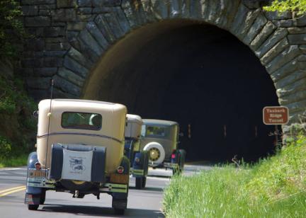
- Milepost 375: Tanbark Ridge Tunnel & Trailheads: Currently accessible. After descending from Craggy toward Asheville, you'll pass through Tanbark Ridge Tunnel (MP 375). Just before the tunnel, there's a pull-off for Rattlesnake Lodge Trail, which leads to the ruins of a historic 1900s mountain lodge (about 1.4 miles one-way uphill). Farther south at MP 376.6, Ox Creek Road intersects (leading down to Weaverville). If you exit here and go 4 miles to the end of Ox Creek Road, you can visit the Vance Birthplace State Historic Site on Reems Creek Road. Parking area for the Rattlesnake Lodge hiking trail.
- Milepost 376.6: Ox Creek Road intersects and winds down into the valley. At the end of Ox Creek Road (four miles), take a left on Reems Creek Road to go into the Weaverville area. Take a right on Reems Creek to visit Vance Birthplace State Historic Site.
- Milepost 377.4: Town Mountain Road (NC 694) Intersection: Currently accessible. This unmarked intersection is easy to miss. Turning here takes you down the twisty Town Mountain Road into downtown Asheville (a fun drive with views of the city). There's a small parking area here that also provides access to the Mountains-to-Sea Trail. Turn onto NC 694 (not marked from the Parkway) for a fun drive on Town Mountain Road into downtown Asheville. You can hike on the Mountains to Sea trail from the small parking area there.
- Milepost 382, Folk Art Center: Currently accessible. A must-stop as you approach Asheville. The Folk Art Center is home to the Southern Highland Craft Guild and showcases some of the finest Appalachian arts and crafts. Browse three galleries of traditional and contemporary crafts, watch daily craft demonstrations, and shop for handmade souvenirs. There's also an information desk and restrooms. Hours: Open year-round, typically 10 am–5 pm daily (closed major holidays). Read more about the Folk Art Center.
- Milepost 382.6: US 70 (Asheville exit): Currently accessible (ungated). Here, the Parkway crosses US Highway 70 just east of Asheville. This is one of the main entrances to the Parkway for Asheville. (If you exit, go west to head into downtown Asheville (about 5 miles) or east to reach I-40 toward Black Mountain, about 10 miles away.).
- Milepost 384, Parkway Visitor Center: Blue Ridge Parkway Visitor Center (Asheville): Currently accessible. Stop here for a wealth of information, maps, and exhibits. This modern visitor center (at 195 Hemphill Knob Rd) features interactive displays on Parkway history and nature, a 22-minute high-definition film, and a gift shop. Rangers can answer questions about road conditions and hiking. Hours: Open daily 9 am–5 pm (year-round except Thanksgiving, Christmas, New Year's). (The Parkway's headquarters office is also on site.)
- Milepost 384.7: US 74A (Asheville exit): Currently accessible (ungated). Another Asheville access point. Exiting here and heading east on 74A takes you toward Chimney Rock State Park and Lake Lure (25 miles). Head west to find I-40.
- Milepost 388.8: US 25 (Hendersonville Road) Crossing: Currently accessible. Travel north three miles to the Biltmore Estate or south to reach I-26 South toward Hendersonville.
- Milepost 393.6: NC 191 (Brevard Road) Crossing: Currently accessible. Another key Asheville-area junction. Exit here for the North Carolina Arboretum, a 434-acre public garden with extensive trails and exhibits (located just below the Parkway). This is also the gateway to Bent Creek Experimental Forest, popular for mountain biking and Lake Powhatan camping and glamping. NC 191 north leads into Asheville and I-26; south leads toward the Mills River and Fletcher areas. Exit here for the NC Arboretum (adjacent to Parkway),
- Milepost 400.3 – Bent Creek Gap: Currently accessible. Just past where the Parkway crosses over the French Broad River, you'll reach Bent Creek Gap. A gravel Forest Service road (FS 5000) descends here into Bent Creek (usually gated in winter). This area was impacted by Helene; the junction was temporarily closed for repairs. It's also near Ferrin Knob (MP 401), where road stabilization work is underway (scheduled to finish by summer 2025).
- Milepost 404.5, Mills River Valley Overlook: Currently accessible. A stunning overlook facing east. Come at sunrise to see the morning mist in the Mills River valley light up with the first rays – it's one of our favorite dawn views, with layer upon layer of mountain ridges unfolding. On clear days, you can spot the Hendersonville area far in the distance.
- Milepost 407.6, Mt. Pisgah Trail: Currently accessible. Here you'll find the trailhead to Mt. Pisgah (5,721 ft). The hike is a moderately strenuous 1.5-mile climb to the summit's observation platform, but the panoramic view is worth the effort. At Milepost 407.8, there's a picnic area (currently closed for the season). See our Mount Pisgah Hiking Guide.
- Milepost 408.7, Pisgah Inn: Currently accessible. The Pisgah Inn is the only lodge and full-service restaurant directly on the Parkway in North Carolina. Perched at 5,000 ft, its dining room has huge windows with breathtaking mountain views – a perfect lunch stop or overnight stay. There's also a country store and campground nearby (MP 408.8). Season: Open from April through October. (Expected to operate for the 2025 season on April 1. Visitors can reach Pisgah Inn via the main Parkway route or detours via NC 151 up to Parkway MP 405 or US 276 up to MP 411.) Read more.
- Milepost 409.6, Fryingpan Mountain Lookout Tower: Currently accessible. Look for a gated US Forest Service fire road on the right. A 1.5-mile round-trip hike up this road leads to the Fryingpan Mountain fire tower (70 feet tall). Climb the stairs (at your own risk) for a spectacular 360° view – it's actually higher than Mount Pisgah's summit view due to the tower height.. Read more about Fryingpan Mountain Tower.
- Milepost 412: US 276 Crossing: Currently accessible. Forest Heritage Scenic Byway. Take a beautiful drive south through Pisgah National Forest to Pink Beds Hike (4 miles), Cradle of Forestry (4 miles), Sliding Rock (8 miles), Looking Glass Falls (10 miles), and Brevard (18 miles). Head north to Waynesville (22 miles).
- Milepost 412, Cold Mountain Overlook: Currently accessible. Shortly past the 276 junction is a pull-off with a view of Cold Mountain (the 6,030-ft peak made famous by the novel and film). Elevation here is about 4,500 ft. On clear winter days, the distant profile of Cold Mountain is visible; interpretive signs share the history. Read more about Cold Mountain. Read more about Cold Mountain.
- Milepost 413.2 Pounding Mill Parking Overlook: Currently accessible. This overlook is known as an autumn hotspot for monarch butterflies. In early fall, monarchs migrating to Mexico often gather here, attracted by abundant wildflowers – it can be magical to witness dozens of butterflies fluttering around. (Pounding Mill is also a trail access point for the Mountains-to-Sea Trail.)
- Milepost 417, Looking Glass Rock Overlook & Skinny Dip Falls: Currently accessible. The huge granite dome of Looking Glass Rock is prominent to the east. In winter, it glistens with ice, reflecting sunlight (hence the name). Park here to access Skinny Dip Falls trail – a half-mile hike to a refreshing waterfall and pool popular for summer wading. (Note: The trail was impacted by a flood in 2021 but has since been rerouted; check current status.) For experienced hikers, a challenging 6.5-mile round-trip trail (from US 276) leads to the summit of Looking Glass Rock for great views. Hike to the top of Looking Glass from U.S. 276.
- Milepost 418.8, Graveyard Fields: Currently accessible. A large parking area marks Graveyard Fields, one of the most unusual landscapes on the Parkway. A high-elevation valley, it was partially logged and burned a century ago, leaving stumps that resembled headstones (hence the name). Today it's a mix of open meadows and new forest. Hike the loop trail to see Lower and Upper Falls (both relatively easy hikes, though often crowded). Blueberry bushes here produce lots of fruit in late summer, attracting visitors and bears alike. Elevation ~5,120 ft. Read more about Graveyard Fields.
- Milepost 420.2, Black Balsam: Currently accessible, but Parkway closes just past this point. At the Black Balsam area, the Parkway reaches some of its highest elevations. FS 816 is a short side road (to the right) leading to trailheads for Black Balsam Knob and Sam Knob – two spectacular bald summits above 6,000 ft. From Black Balsam Knob's grassy top, you get uninterrupted views in all directions. On a clear day, you can spot the distant smoke plume from Cherokee's steam plant to the west and Asheville's skyline to the east. These hikes are moderate (about 1.5–2 miles round-trip). See our guides for Black Balsam Knob and Sam Knob. Note: The Parkway is closed just past this junction (MP 420.2–423.2) due to road damage, so you cannot continue by car to the next overlooks. However, FS 816 and the trails are open.
- Milepost 422.4, Devil's Courthouse: Currently inaccessible due to road closure. This dramatic rocky peak looms to the right of the Parkway. A steep 1/2-mile paved trail climbs from the parking area to the summit of Devil's Courthouse (5,720 ft). From the top, enjoy a 360° panorama including four states on a clear day. Peregrine falcons nest on the cliff ledges (parts of the cliff are off-limits to protect them). See our Devil's Courthouse Guide and Photos. Elevation at parking area, 5,462 feet.
- Milepost 423.2: NC 215 Intersection (Beech Gap): Currently accessible (northern end of open section). The Parkway crosses NC 215 here at Beech Gap. North on NC 215 leads down toward Canton and Brevard. Along NC 215, about 13 miles north, is the trailhead for the Cold Mountain summit hike in the Shining Rock Wilderness, as well as roadside falls like Wildcat Falls and Sunburst Falls. Heading south on NC 215 takes you toward Rosman, with several waterfalls on that route too (e.g. Courthouse Falls, Cathedral / French Broad Falls at Living Waters, and Dill Falls off a FS road). Just off NC 215 south of the gap is the Pisgah Astronomical Research Institute (PARI), a former NASA facility now an active space education center open for visits. Note: Use NC 215 as a detour route when traveling between closed sections – this connects to the southern open section at Balsam Gap (MP 443).
- Milepost 430, Cowee Mountains Overlook: Currently accessible. Past the closures, as you near the Smokies, the Parkway reaches some of its highest points. Cowee Overlook (elev. 5,950 ft) is famed for its sunsets. On clear evenings, people gather here to watch the sun sink behind layer upon layer of blue ridges – truly one of the best sunset spots on the entire Parkway.
- Milepost 431.4, Richland Balsam Overlook: Currently accessible. This is the highest point on the Blue Ridge Parkway (elev. 6,053 ft, as noted by the sign). There's a short self-guiding loop trail (1.5 miles) through the fragrant spruce-fir forest to the summit of Richland Balsam. Even in summer, it can be cool up here. See our Richland Balsam Guide. See our Richland Balsam Guide.
- Milepost 443.1: Balsam Gap (US 74/23 Junction): Currently accessible. Here, the Parkway crosses U.S. 74/23 at Balsam Gap. Many travelers use this as a jumping-off point to or from Asheville: from here, you can take US 23/74 east 9 miles to Waynesville and then I-40 East back to Asheville (about 30 miles total). Southbound, US 23/74 leads toward Sylva and Dillsboro in Jackson County. or can connect to US 441 to Franklin.
- Milepost 451.2, Waterrock Knob: Currently accessible. A large visitor center and overlook at a lofty spot (elev. 5,820 ft). Waterrock Knob offers an almost 360-degree view from the parking lot – you can see Clingmans Dome to the west and Mt. Pisgah to the east on clear days. It's another prime sunset location. A steep 1.2-mile round-trip trail leads to the summit of Waterrock Knob (6,292 ft) for even better views. There's a small museum inside the visitor center, and restrooms are available. See our Waterrock Knob Guide. (The Waterrock visitor center is generally open May–October and is expected to operate in 2025.)
- Milepost 455.7: Soco Gap (US 19): Currently accessible. At Soco Gap, the Parkway meets US 19 between Maggie Valley, Cherokee, and Harrah’s Cherokee Casino. Exit here to head 5 miles down into Maggie Valley or continue 13 miles on US 19 to Cherokee. Just 1.5 miles east on US 19 from Soco Gap is Soco Falls, a beautiful double waterfall that's a short walk from a pull-off. This is a convenient last stop if you're leaving the Parkway here.
- Milepost 458.2, Heintooga Road: Currently accessible. A spur road to the right leads to a high overlook and into Great Smoky Mountains National Park. Heintooga Ridge Road winds 9 miles to the mile-high Balsam Mountain Campground (NPS, seasonal) and further to Heintooga Round Bottom Road, a one-way gravel road that descends into Cherokee. These roads are typically open late May through October. Read more about Balsam Mountain and Heintooga Road. (Note: This spur is usually closed in winter). Read more about Balsam Mountain and Heintooga Round Bottom Road.
- Milepost 469.1: Southern Terminus at Cherokee (US 441): Currently accessible. The Blue Ridge Parkway ends here as it intersects US 441, just outside the entrance to Great Smoky Mountains National Park. Be sure to stop at the Oconaluftee Visitors Center in the national park (2 miles north on US 441) to learn about the Smokies and see the Mountain Farm Museum. From this point, you can head into GSMNP toward Newfound Gap and Gatlinburg, or go south on US 441 into Cherokee, the cultural center of the Eastern Band of Cherokee Indians (with museums, shops, and Harrah's Cherokee Casino). Congratulations – you've traversed the North Carolina Blue Ridge Parkway!
Parkway Hiking & Outdoors
The Blue Ridge Parkway offers hundreds of miles of hiking trails, from short nature walks to portions of the long-distance Mountains-to-Sea Trail. Nearly every overlook hides a trailhead or a path to explore. Signage for trailheads is limited, so research hikes in advance. Some popular hikes in the NC section include those listed above (Rough Ridge, Linville Falls, Craggy Pinnacle, etc.) and many more. See our 16 Quick Hikes on the Parkway for a curated list of short hikes, or browse the For more options, see our Asheville Top 75 Hikes. for broader options. (Above: Rough Ridge boardwalk trail)
Waterfalls: Don't miss the many waterfalls along or near the Parkway. Some are right beside the road (Looking Glass Falls), while others require a short hike (Linville Falls, Crabtree Falls). See our list of the Top 10 Parkway Waterfalls in NC – many are within a 5-10 mile detour of the main road.
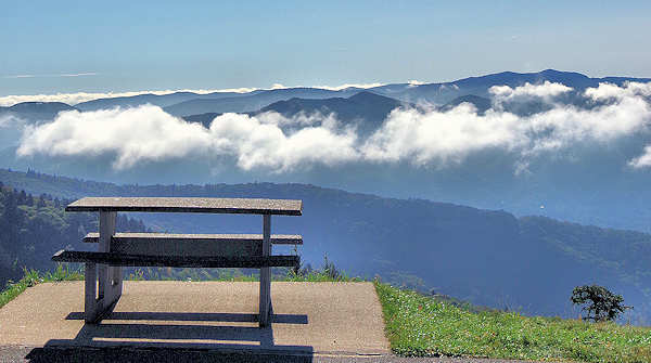
Picnic Areas: Pack a picnic and enjoy it with a view. There are designated picnic areas at places like Price Park (MP 296), Linville Falls (316), and Mt. Pisgah (408). Note that some picnic areas like Crabtree Falls (340) and Craggy Gardens (367) are currently closed due to road closures. They offer tables, and sometimes grills and restrooms. You can also spread a blanket at any overlook or pull-off (just practice Leave No Trace). See our guide to Best Picnic Spots on the Parkway for ideas.
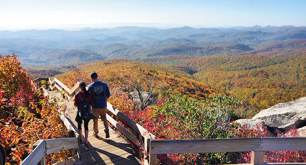
Wildlife, Nature, and Fall Foliage: Keep an eye out for wildlife. You might see wild turkeys, deer, or the occasional black bear (especially in the more remote stretches). Late spring and summer bring wildflowers – flame azaleas around June, mountain laurel, and rhododendrons at higher elevations in June-July. In fall, the foliage is world-famous – check our Fall Color Forecast for timing and tips to catch peak colors.
Weddings: Read about eloping on the Parkway.
Tips for Driving the Blue Ridge Parkway
Driving the Parkway is unlike driving a regular highway. Remember, it's all about the journey. Here are some tips for a safe and enjoyable trip:
Obey the speed limit (45 mph max) and go slower when enjoying views. There are no stop lights or stop signs along the Parkway, but also no shoulders in many areas – it's not meant for rushing. Be prepared for sharp curves and elevation changes. If local traffic or cyclists are behind you, use overlooks to pull over and let them pass.
Use overlooks and pull-offs to soak in the scenery. There are nearly 200 overlooks, marked by signs – each with its own unique view or historical info. If an overlook is crowded, consider walking a bit down a trail for solitude.
Don't rely on GPS navigation. Cell coverage is spotty, and GPS directions can be unreliable on the Parkway (some devices might even try to route you off the road in odd ways). Instead, use milepost markers and a map. The official Blue Ridge Parkway Map (available as a PDF or at visitor centers) is very handy. See a map of the Asheville area of the Parkway.
Gas up before you go. There are no gas stations on the Parkway itself. Towns and highways crossing the Parkway often have gas – for example, Cherokee, Waynesville, Asheville, Spruce Pine, etc. Plan your fuel stops; running out of gas in a remote stretch is no fun.
Facilities and restrooms: Restrooms are available at major stops (visitor centers, picnic areas, popular trailheads). Most facilities (including visitor centers, campgrounds, and picnic areas) operate seasonally – generally open mid-spring through fall and closed in winter. For instance, the Asheville Visitor Center (MP 384) and Folk Art Center (MP 382) are open year-round, but many others, including Craggy Gardens Visitor Center and Waterrock Knob Visitor Center, are open May to October. Check the NPS site for specific hours. In winter, even open facilities may have no water (restrooms winterized), so plan accordingly.
Weather and road conditions: Weather can change quickly, especially as you gain elevation. A sunny 70°F day in Asheville could be a foggy 50°F up at Craggy Gardens. Always bring layers – even in summer, higher sections can be chilly or breezy. Afternoon thunderstorms are common in summer; if storm clouds roll in, be cautious of slick roads. In late fall and early spring, ice or snow can close sections at higher elevations. Winter closures (Nov–March) are common and not always posted far in advance – gates will be closed where the road is impassable. For real-time road status, check the NPS online closure map or call the Parkway information line at 828-348-3400 (NPS Asheville).
Detours around closures: If you encounter a closed gate, do not drive around it. Turn around and use alternate routes (major closures will have signed detours). For example, in 2025, large portions in NC are closed – you can detour via US 221 between Linville and Marion for the Linn Cove/Little Switzerland gap, via highways like US 70/I-40 between Craggy and Asheville, or via NC 215/US 276 around the Pisgah area closure. The Blue Ridge Parkway official site and social media provide updates on reopened sections. Be patient – crews are working to restore the Parkway fully after Helene's unprecedented damage, but some repairs (like at landslide sites near Little Switzerland and Pisgah) take time.
Bicyclists and motorcyclists: The Parkway is popular with cyclists. Bicycles share the road, so drive cautiously around blind curves and give cyclists plenty of space when passing. Motorcyclists should also be alert for wildlife and wet patches (which can be slick, especially in shaded curves). Helmets are required for motorcyclists in NC. Note that bicycles are not allowed on hiking trails. See our Biking Tips for the Parkway.
Wildlife: Watch for deer darting across the road, especially at dawn or dusk. Hitting a deer at 45 mph can ruin your trip. Smaller critters like turkeys, grouse, or even bears might cross, too. If you see motorists stopped in the road, they might be watching wildlife – slow down and do the same (but pull off the pavement if possible).
Leave No Trace: Help keep the Parkway beautiful. Don't pick plants or feed wildlife. Carry out any trash. If you stop along roadsides, make sure your vehicle is completely off the pavement and not in a ditch. Learn more about the Leave No Trace principles.
Emergencies: In case of an emergency on the Parkway, call 1-800-PARKWATCH (or 911, but note that location finding may be harder on 911). This will connect you to park dispatch. Know your approximate milepost or nearest landmark to describe your location.
By following these tips and staying informed, you can safely enjoy "America's Favorite Drive" even with a few detours. The views are well worth it!
Getting On/Off the Parkway around Asheville
Asheville is an ideal base for exploring the Blue Ridge Parkway. There are five entrances to the Parkway in the Asheville area:
- US 70 East (Exit 55 off I-40): This puts you on the Parkway at Milepost 382, near the Folk Art Center. Use this for heading north from Asheville (toward Craggy Gardens, Mount Mitchell, etc.). Note: Due to current closures, you can only travel a short distance north before encountering closed sections.
- US 74A East (near I-40 Exit 53A): Access at Milepost ~384.7, by the Parkway Visitor Center. Good for either direction; east leads toward Fairview and Chimney Rock when exiting.
- US 25 South (Hendersonville Rd, near I-40 Exit 50): Parkway crosses at MP 388.8. This is in south Asheville; use it to head south on the Parkway toward Mount Pisgah.
- NC 191 South (Brevard Rd, near I-26 Exit 33): This is Milepost 393.6 by the NC Arboretum. Best for heading south on the Parkway (toward Pisgah, as well as detouring to the Arboretum).
- Town Mountain Road (NC 694): In north Asheville, this winding road climbs to meet the Parkway at Milepost 377.4. There's no sign on the Parkway, but it's 2 miles north of the Craven Gap overlook. This is a fun, curvy route from downtown Asheville to the Parkway's elevations. Note: This access point is currently within a closed section.
There are no direct interstate highway exits onto the Parkway – you must use these local roads. When returning, you can leave the Parkway at any of the above and follow signs back to Asheville or to I-40/I-26. Also, to return more quickly from a long Parkway drive, it's often fastest to exit the Parkway and use a highway. (See the loop trips below for examples.)
Keep in mind that higher-elevation sections around Asheville (Craggy, Pisgah) close in winter for snow/ice and usually reopen by late March or April. So if you're visiting in winter, you might only be able to drive the lower sections near the city. The Parkway itself is open 24/7 year-round where not otherwise closed, but the gates will close for unsafe conditions. Facilities have varying seasons (generally April–October).
Scenic Loop Drives from Asheville
If you don't want to drive the entire 175-mile stretch, consider these half-day loop trips from Asheville that showcase great parts of the Parkway and then return via faster highways. Note: Due to current closures, these loops may require modifications:
Modified North Loop: Drive north from Asheville (enter at US 70, MP 382) to the currently accessible northern sections around Grandfather Mountain/Linn Cove Viaduct area (if approaching from alternate routes like US 221). Due to extensive closures between Asheville and the northern sections, you'll need to exit the Parkway and use highway detours (such as US 70 to I-40 to US 221) to reach the open northern sections. The northern sections from Blowing Rock to Linville (MP 294-317) remain spectacular and accessible.
South Loop: Drive south from Asheville (enter at NC 191, MP 393) about 50 miles to Milepost 443.1 (Balsam Gap). This 2.5-hour Parkway segment winds up to Mount Pisgah, through numerous tunnels, and across the highest sections in the Balsam Mountains (Richland Balsam, etc.), with spectacular long-range views. At Balsam Gap, exit onto US 74 East/US 23 North toward Waynesville. From Waynesville, take I-40 East back to Asheville (about 30 miles, ~30–40 minutes). Total loop: ~120 miles (allow ~4 hours with stops). This loop is currently feasible as the southern sections from Asheville to Cherokee are largely open.
These loops let you experience high-elevation portions of the Parkway and still get you back to Asheville by the end of the day. Always ensure you have a full tank of gas and daylight for the Parkway portion, as gas and lighting are unavailable on the drive. Check for current closure statuses before departing because conditions change frequently during the recovery period.
Additional Resources
For even more Parkway hike ideas: 16 Quick Hikes on the Blue Ridge Parkway (short hikes ideal for a quick leg-stretch or picnic).
For current road status and driving tips: Blue Ridge Parkway: Closures & Driving Tips (RomanticAsheville's running update page).
For waterfall enthusiasts: Top 10 Parkway Waterfalls in NC – from Linville Falls to Soco Falls.
For fall travelers: Blue Ridge Parkway Fall Color – Top 20 NC Spots to catch the best autumn views.
For picnic lovers: Picnics on the Blue Ridge Parkway – best picnic areas and tips.
For a scenic drive outside the Parkway: Best of the Blue Ridge Scenic Loop (a loop drive in Transylvania County with waterfalls and panoramic overlooks).
Enjoy your journey on the Blue Ridge Parkway! Despite the current detours and ongoing recovery from storm damage, the NC High Country's beauty endures – around every bend, there's another breathtaking view awaiting you. The dedicated work of the National Park Service continues to restore access to this national treasure. Safe travels and happy exploring on America's Favorite Drive.